Breiðamerkursandur
Breiðamerkursandur became a part of Vatnajökull National Park in 2017. It is located within the municipality of Hornafjörður, west of the town Höfn. Jökulsárlón is one of the main destinations of Breiðamerkursandur along with Fjallsárlón.
Nature
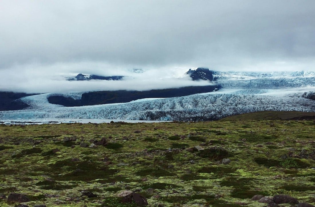
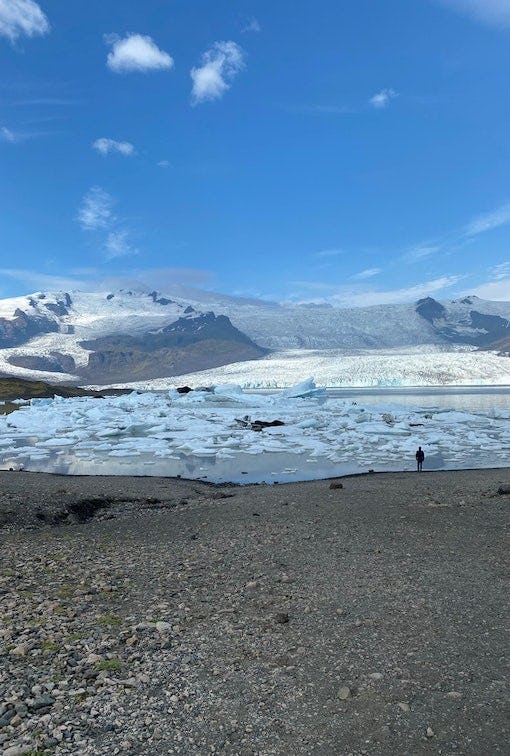
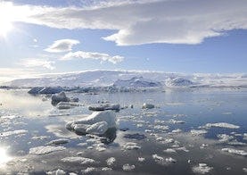
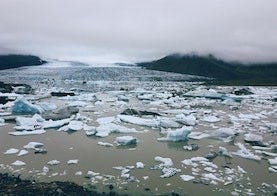
Breiðamerkursandur, the outwash plain south of Breiðamerkurjökull, displays some of Iceland’s most accessible landscapes formed by glaciers. The area has been changing rapidly, and in a rather short time it is possible to study the scenario of these changes in the landscape due to the fast retreat of the glaciers. The fastest changes can be seen at Breiðamerkurjökull, especially at the front of the glacier where it calves into Jökulsárlón. The icebergs on Jökulsárlón are some of the main attractions in the area. Breiðamerkursandur is also an important nesting grounds for various bird species, such as the Great skua and the Barnacle goose. Scientific research is conducted in these ever-changing surroundings, both on the landscape as well as on the colonization of the biosphere.
The area has a diverse fauna, and several reindeer herds stay on the eastern side of Breiðamerkursandur during the winter. Please take caution when driving through the area, as they tend to run across the road.
History
Breiðamerkursandur is between the rivers Kvíá and Fellsá and was formerly called Breiðársandur after the farm Breiðá. Place names in the area provide evidence of habitation from the first centuries of the settlement of Iceland. At the time, the glaciers were smaller, but later the plain was covered with vegetation. In the 13th century, the climate began to cool, and as a result, glaciers advanced. Breiðamerkurjökull advanced until the 18th and 19th centuries. Only about 250 metres separated the glacier and the sea where the distance between them was shortest. Massive changes in landscape have taken place on Breiðamerkursandur after the glacier began to retreat in the beginning of the 20th century. Lakes began to appear in the 1930s as the glaciers retreated. The largest lakes are Jökulsárlón, Breiðárlón and Fjallsárlón. Each of them is fed by a calving glacier, but with the continued retreat of the glaciers, the lakes keep growing. The land that appears with the retreat is characterized by the sediments formed under the glacier.
According to Landnáma, (the Book of Settlements), the settlement of Breiðamerkursandur began almost 1100 years ago, almost immediately after Iceland’s settlement began. At that time, Ari Fróði’s Íslendingabók (the Book of Icelanders), tells us that the land was forested from the mountains and all the way to the shore. It is hard to imagine farming on Breiðamerkursandur as we know it today, let alone building a farm in the middle of the plain. The conditions have changed drastically, and the nature is more difficult for farming than it was in the first centuries of settlement.
Destinations
Hiking
Jökulsárlón
You walk from the main parking lot north towards the glacier and up to the glacier ridge called Helguhóll.
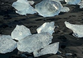
Eystri-Fellsfjara
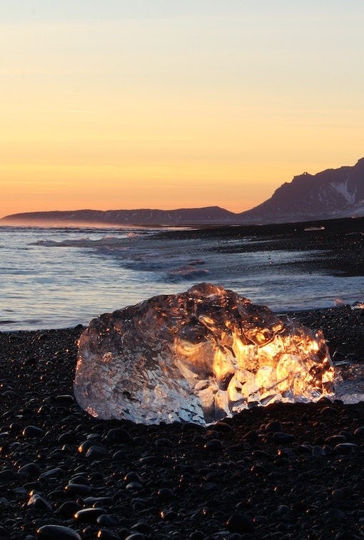
A beautiful hiking trail that along Eystri-Fellsfjara, where you can see icebergs in the black sand.
Fjallsárlón
This hiking trail goes along Fjallsárlón where you can admire the beautiful lagoon and Fjallsjökul.