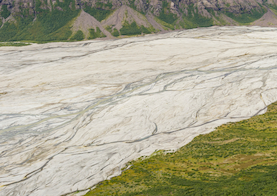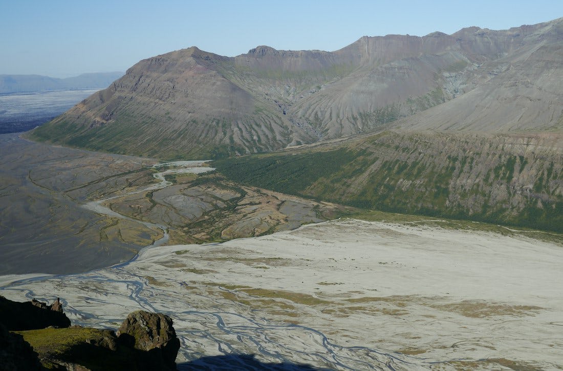
Morsárdalur
In Morsárdalur there is the forest Bæjarstaðarskógur, which has the tallest birch trees in the country even though it does not cover a large area. Rowan trees grow here and there in the wood and the ground vegetation is varied. It is believed that the farm Jökulfell stood in this area. Here also ended the colonisation of Þorgerður the Settler who lead her cow from sunrise to sundown from the Kvíá river in the east to the Jökulfell mountains in the west.
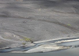
Innermost in the valley Morsárjökull extends down from perpendicular cliffs, and in warm weather rumblings and cracks can be heard from long distances when snow and large ice chunks cascade from the cliff base in a tall glacial waterfall.
Mynd: tupungato, iStock
Hiking
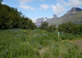
Bæjarstaðarskógur
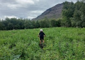
Those who are going to Bæjarstaðarskóg can choose a marked path that leads to Jökulfell and the ravines at Bæjarstaður. From there it is ideal to walk the path through the forest and across the valley, and then follow the path along Morsá back. You can also go diagonally up Grjóthóll and Vesturheiði and back down at Bæjargil (see route M2 and M3 on the map).
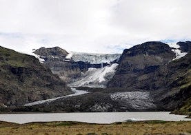
Morsárjökull
Morsárjökull is a scenic glacier in Morsárdalur valley. The ice falls of the cliff and in summer time hikers can often hear the ice falling. On top of the glacier lays a landslide from 2007.
Bæjarstaðarskógur - Visitor trail
A trail that leads from Skaftafellstofa and into Bæjarstaðarskógur. If you follow the southern trail into Bæjarstaðarskógue, five signs have been put up from Lambhagi and inside Bæjarstaðarskógur with information and interpretation about folk live, wildlife and more.
Bæjarstaðarskógur - M1
In this description, it is assumed that you are going into Bæjarstaðarskóg by bike.