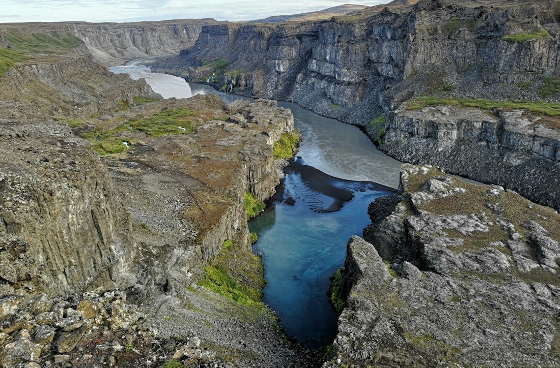
Hafragil lowland
The area in and surrounding Hafragil lowland contains the most difficult but also the most facinating hiking trails in Jökulsárgljúfur and caution should be exercised since the trail is steep and there is a risk of falling rocks.
The area in and surrounding Hafragil lowland contains the most difficult but also the most facinating hiking trails in Jökulsárgljúfur and caution should be exercised. The route to the Hafragil lowland starts at a small car park by the turn off to Hafragil waterfall. From there you go east towards the river and you approach the lowland via Sanddalur. There is a fixed rope to help you down a rocky section. Next you have to descend a steep and rocky slope and then the walk continues past the majestic Hafragil waterfall and through a rocky landslide along a small cove, Fossvogur, under a vertical rock face. This trail is not for people afraid of heights. The route back up takes you into the Hafragil gorge, following sheep tracks up the slope. When up at the rim you head south and follow the Hafragil gorge on the west side until back at the small car park.
Connected hikes
Dettifoss
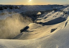
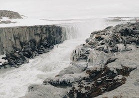
Dettifoss is the most powerful waterfall in Europe. The menacing power can be felt by placing your palms against the cliffs near the waterfall and feeling how the rock vibrates. Bit by bit, the waterfall digs its way through the edge of the waterfall and thus moves itself further south or about half a meter a year.
From the parking lot to the viewpoint at Dettifoss, it is a 1 km walk (one way). From there you can walk the same way back to the parking lot.
Dettifoss and Selfoss
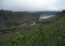
Contrasting landscape is one of the main characteristics of Jökulsárgljúfur. This trail reveals the most powerful waterfall in Europe, Dettifoss, against the humble and beautifully shaped Selfoss waterfall. From the parking area to Dettifoss is a 1 km walk (one way). It is possible to go the same way back. However, it is interesting to keep on south, along the riverbank towards Selfoss and then go the more westerly route back to the parking area and close the circle.
Ásbyrgi to Dettifoss - Canyon Trail
The trail between Ásbyrgi and Dettifoss is 32 kilometers through Jökulsárgljúfur canyoun. Points of interest Jökulsárgljúfrum. Hiking up along the Jökulsárgljúfur canyon, from the luxuriant Ásbyrgi to the barren but magnificent environment around Dettifoss, is a unique experience for every hiker. The diversity of the landscape is unique and captures the eye at every footstep: tremendous gorges, quiet ponds, clear springs, rough river, luxuriant forests and bare gravel plains. Two days are recommended for the whole hike. On the route there are no cabins and it is only allowed to camp on the park campsites at Vesturdalur and Dettifoss.