Glaciology
How do glaciers form?
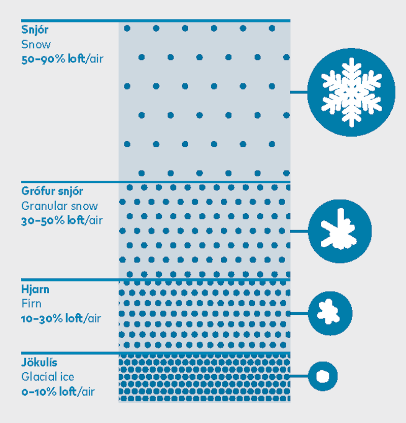
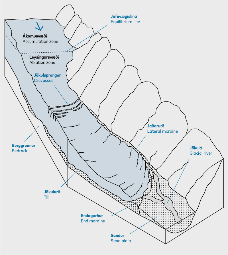
Glacial ice is composed of ice crystals, snow, air, water and sediments. Glaciers are mainly formed from compressed snow, with only a small proportion due to freezing of water. Glaciers form when more snow accumulates over the year than melts during the summer. As layers of snow accumulate, the buried snow grains become more and more tightly packed and are converted to firn which subsequently metamorphoses to glacial ice as the firn recrystallizes. This process takes place in the accumulation area at the higher altitudes. The thick mass of ice deforms under its own weight and flows downstream like dough or molten metal. The ice flows downhill towards the ablation area where melting exceeds the accumulation of snow over the year.
Equilibrium line
The line that separates the accumulation and ablation areas is called the equilibrium line. The elevation of the equilibrium line depends on temperature, precipitation and the surrounding landscape. If the climate conditions remained constant, neither the equilibrium line nor the glacier margin would change.
At present, the equilibrium line altitude on southern Vatnajökull is generally in the range of 1000–1200 m above sea level, but it varies from place to place. At the end of the Little Ice Age, the equilibrium line on southeastern Vatnajökull was probably some 300 m lower than today. The accumulation areas of the south flowing outlet glaciers were thus much larger. Due to lower temperatures and a shorter melt season, there was less ablation and outlet glaciers advanced down valleys and far out onto the lowlands.
Why is the glacier blue?
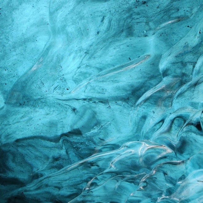
Ice is blue because it reflects blue light, while it absorbs the red and yellow part of the spectrum. Snow looks white because the air between the snowflakes reflects full spectrum of light (white). Thus, the more air bubbles in the ice, the whiter it looks.
Crevasses
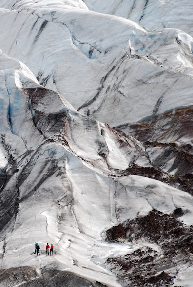
Crevasses are cracks or fractures that open in the surface of a moving glacier in response to stress variations caused by glacier flow. Crevasses range in shape from linear to arcuate and in length from metres to kilometres. Their orientation may be in any direction with respect to the glacier flow. The deepest crevasses may exceed 30 m. Theoretically, the weight of the ice limits crevasse depth to about 30 m. Below that there is typically enough compressive force in the ice to prevent cracks from opening. However, if water enters a growing crevasse, it acts like a wedge to carve an extra deep fracture, sometimes hundreds of m through the entire glacier. The main types of crevasses are longitudinal, transverse and marginal. Crevasses are often hidden under the snow, but many become prominent in late summer. In the ablation area, crevasses are often highly visible, and some are transformed into moulins that extend to the glacier bed.
Jökulhlaups
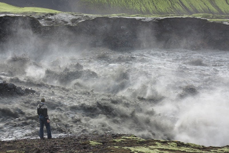
The Icelandic term “jökulhlaup” has been internationally adopted for glacial outburst floods that occur frequently at many locations in Iceland. Jökulhlaups can be extremely dangerous and a significant hazard for settlements. They occur through steady melting of ice above geothermal areas, melting by magma–ice interactions during volcanic eruptions, or through the release of water stored in marginal lakes dammed by glaciers. Jökulhlaups maintain the globally unique sandur plains, to the north and south of Vatnajökull ice cap, as well as rapidly evolving canyons. Jökulhlaups have had a significant role in landscape evolution north of the Vatnajökull ice cap. The 28 km long Jökulsárgljúfur canyon formed during the early Holocene by a few huge jökulhlaups that originated from Vatnajökull (either in Kverkfjöll or Bárðarbunga volcanoes) and flooded the path of Jökulsá á Fjöllum glacial river.
The Grímsvötn subglacial caldera lake, maintained by geothermal heat, is the source of the most widely known jökulhlaups. More than 40 jökulhlaups from Grímsvötn have been reported since the Middle Ages. They were released into the Skeiðará river after travelling 50 km along the bed of Skeiðarárjökull outlet glacier. In the largest jökulhlaups, almost all the Skeiðarársandur outwash plain, ca. 1000 km2 in area was flooded. Skeiðarársandur is probably the world’s largest sandur, or outwash plain, in front of an active glacier. The 100–250 m thick sediments have piled up during the last 10,000 years from the general action of glacial rivers as well as jökulhlaups.
Jökulhlaups have also regularly occurred in the river Skaftá, from the Skaftárkatlar subglacial lakes. Skaftárkatlar (the Skaftá cauldrons) northwest of Grímsvötn are depressions in the glacier surface, surrounded by circular crevasses, formed by geothermal melting at the glacier bed. Geothermal activity causes meltwater to be collected in subglacial lakes at two locations beneath the cauldrons in the surface of the glacier, which is 350–400 m thick in the area of the lakes. When the lake water is released, the surface of the ice cover is lowered by 70–100 m. The ice surface then rises again between jökulhlaups.
Surges
Some glaciers, known as surge-type glaciers, have periods of rapid forward movement, during which they advance much faster than normally. The rapid sliding is induced by sustained high water pressure at the glacier bed. During surges the glacier moves at 100 times its normal speed and the front can advance up to several kilometers in a few months. Surge-type glaciers are characterised by gently sloping surfaces (typically 1.5–4°) and they move too slowly to maintain balance with the snow accumulation. The increasing imbalance is periodically “corrected” by a short-term surge forward. During surges, the mass transport can be up to 25% of the total ice flux during the quiescent period and this often affects large areas of the ice cap, including the location of ice divides, the flow of neighbouring ice basins, the size and shape of the ice cap as well as water flow at the bed of the glacier. Up to 75% of the area of the Vatnajökull ice cap is affected by surges of outlet glaciers, and many of them have a history of regular surges. Since the 1990s, when several outlet glaciers surged, there has only been one surge in Vatnajökull, i.e. in Kverkjökull outlet glacier sometime during the period 2008 to 2011.
Glacier geomorphology
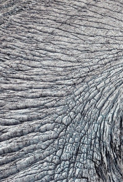
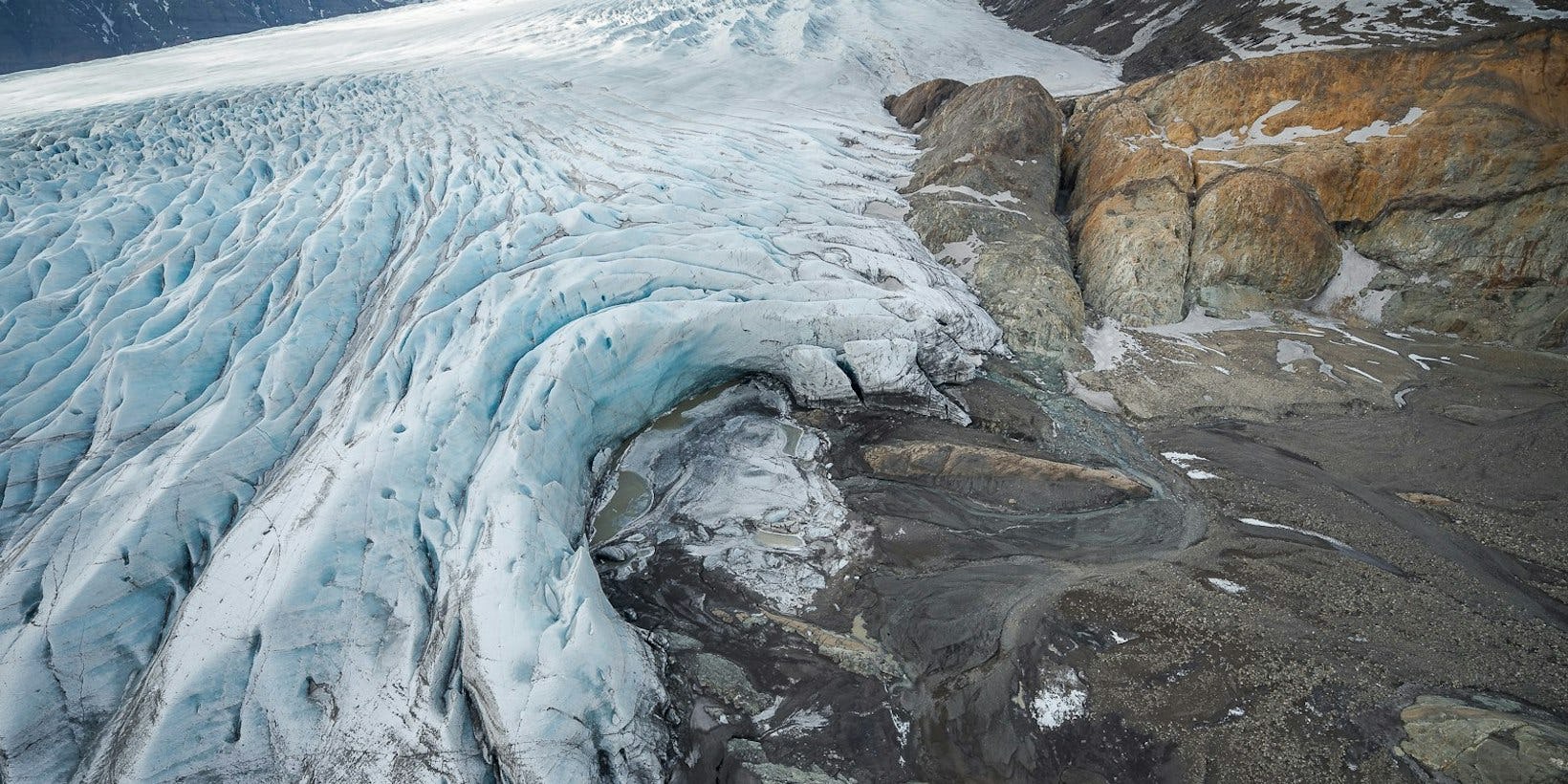
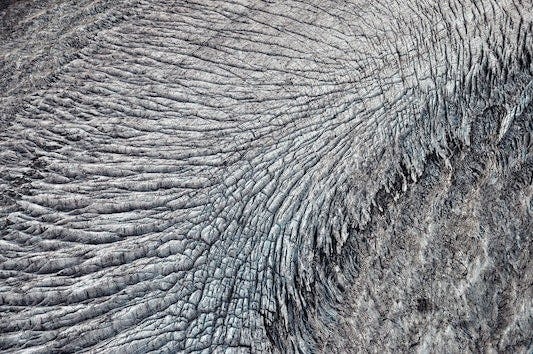
Icelandic geology is characterised by repeated eruptions and glacially eroded strata. The southern outlet glaciers of the Vatnajökull ice cap have greatly influenced the landscape along the coast and created a rugged alpine mountainous area. The outlet glaciers of Öræfajökull have scoured the hills of the volcano and sculptured the surrounding landscape. Glacial landforms include moraines, glacial lakes, dry river beds and jökulhlaup deposits. Scientists interpret these glacial landscapes and determine the extent of the glaciers at different times. Glaciers and glacial rivers reshape the landscape in many ways. The ice itself is too soft to erode the bedrock, but rocks and gravel embedded in the ice carve the glacier bed, creating so-called glacial striations. Glacial debris is carried on top of the glacier, within the ice, and at the interface of the bedrock and ice. The debris is finally deposited at the sides or margin of the glacier as moraines.
Glacial lakes
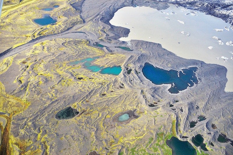
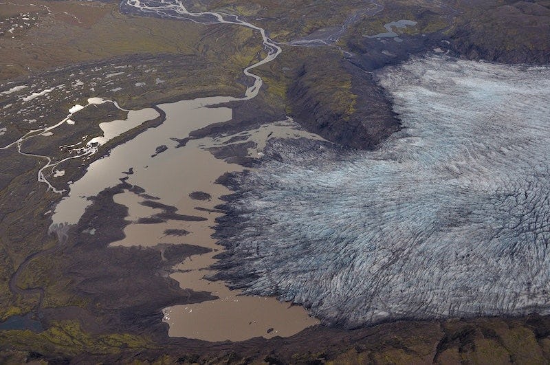
Outlet glaciers can erode over-deepened troughs, and, as they retreat, water accumulates in the depressions evacuated by the ice and glacial lakes form. These lakes enhance melting, as ice chunks break off the glacier tongue in a process called calving. The largest and most active glacial lake in Iceland is Jökulsárlón on Breiðamerkursandur. The Jökulsárlón glacial lake is the mouth of a 200–300 m deep and 25 km long trough that the glacier has carved out.
Glacial lakes have in recent years formed in front of many outlet glaciers of southeast Vatnajökull. Those in front of Svínafellsjökull and Skaftafellsjökull illustrate the development of such lagoons. Small pools initially form that soon merge into an elongated lake between the glacier moraine and the terminus. The lake grows rapidly when the front of the glacier thins, floats up and breaks into pieces. In the end, a large lake may be formed, into which the glacier calves along a steep front.
Types of glaciers
Glaciers can be classified according to their shape, area/altitude distribution, temperature, movement or location. Definitions of some typical glaciers follow:
Glacial meltwater and rivers
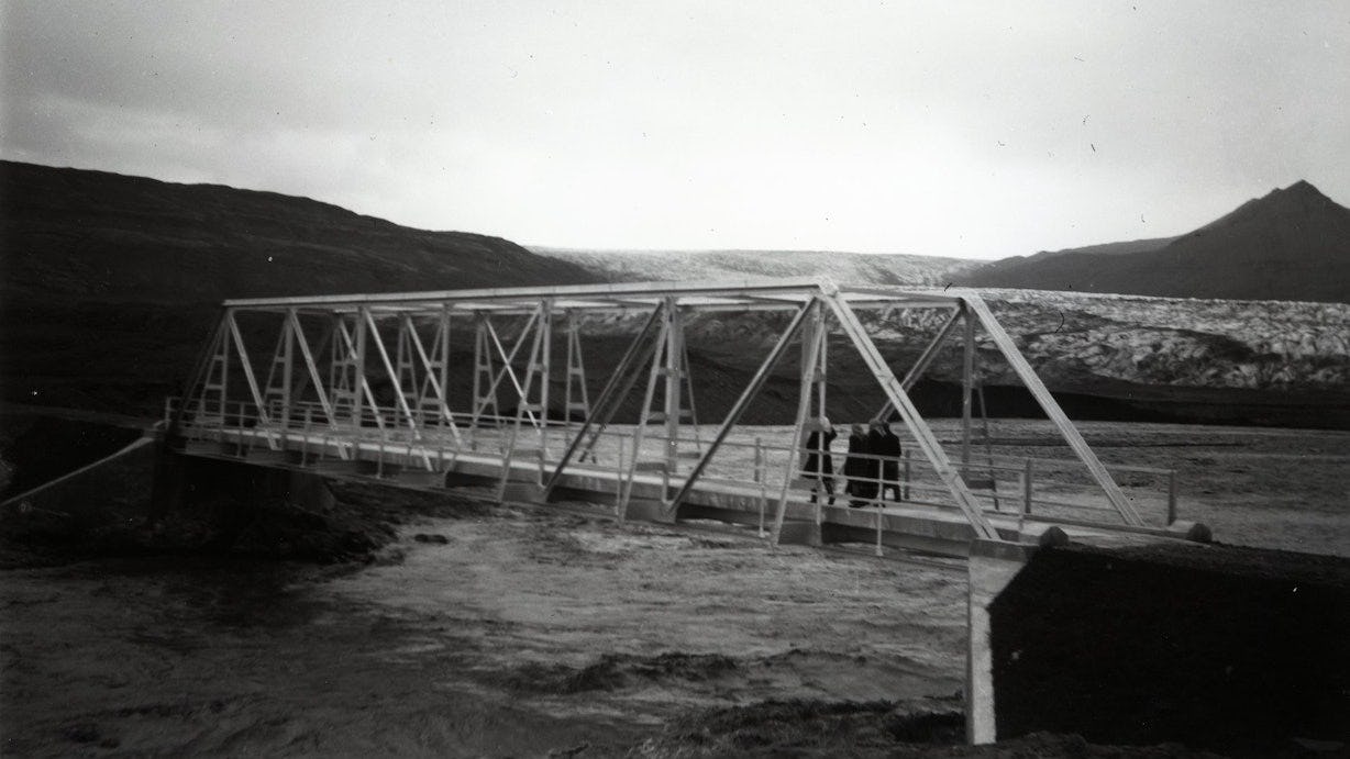
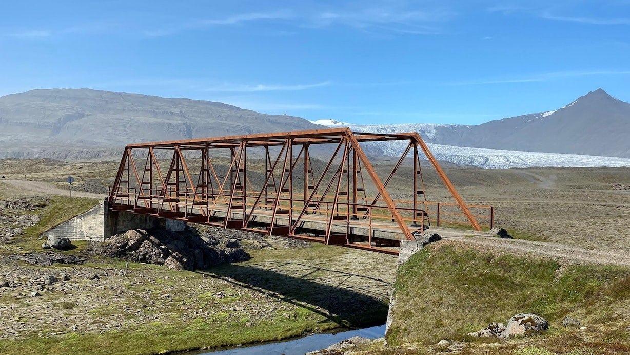
Meltwater exits the glacier in outlets at the snout to form glacial rivers. Glacial rivers are loaded with debris, sand and very fine sediments suspended in the water and make it appear cloudy, sometimes called glacial milk. Due to ever-changing landscapes at glacier margins, rivers can easily change their course, leaving dry river beds and old bridges that have outlived their use. For example, the longest bridge in Iceland over the Skeiðará river has now been dismantled after the river changed course into the Gígjukvísl river in 2009.
Rivers that have changed course since early 20th century (from Halldór Björnsson et al., 2018):
Subglacial eruptions
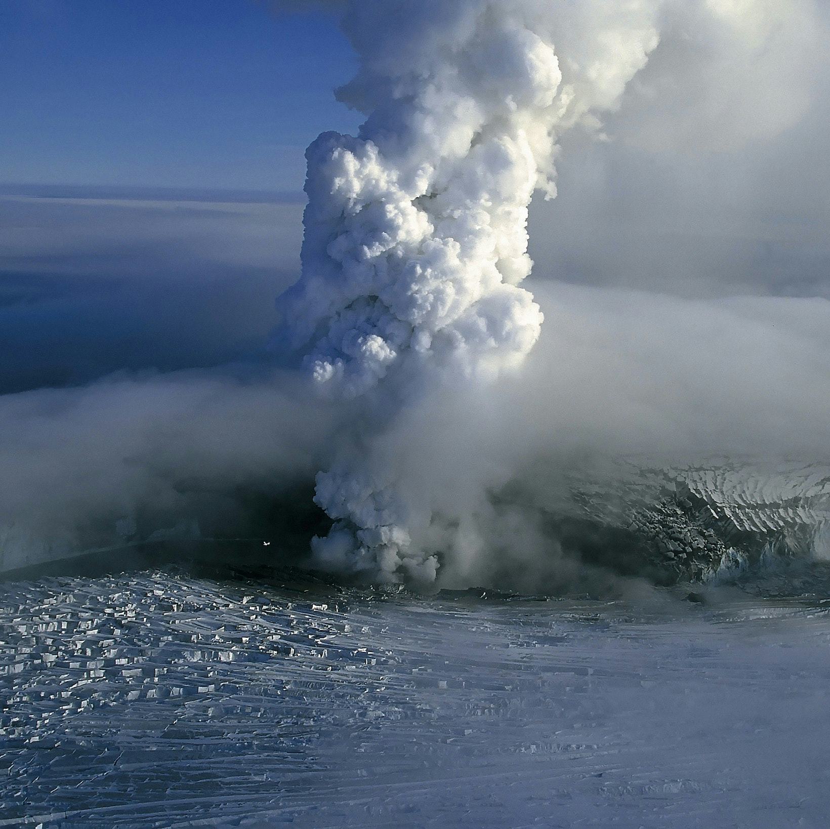
Gjálpargosið 1996. Ljósmynd: Magnús Tumi Guðmundsson.
Vatnajökull conceals a part of the neovolcanic zone and seven central volcanoes, including four of the most active ones in Iceland, Grímsvötn, Bárðarbunga, Kverkfjöll and Öræfajökull. Ice–volcano interactions produce various geological formations. Subglacial eruptions lead to explosive phreatomagmatic tephra production. The tephra is quickly glued together in the moist and hot environment at the eruption site to form breccia or hyaloclastite. Hyaloclastite mountains and ridges are characteristic for the neovolcanic zone of Iceland, but rare elsewhere in the world. During the Gjálp eruption in 1996, a 7 km long hyaloclastite ridge was formed, which is now buried by the glacier. The hyaloclastite formation in Iceland was mostly created by subglacial eruptive activity during the glacial intervals of the Ice Age, when a large ice sheet covered the country.
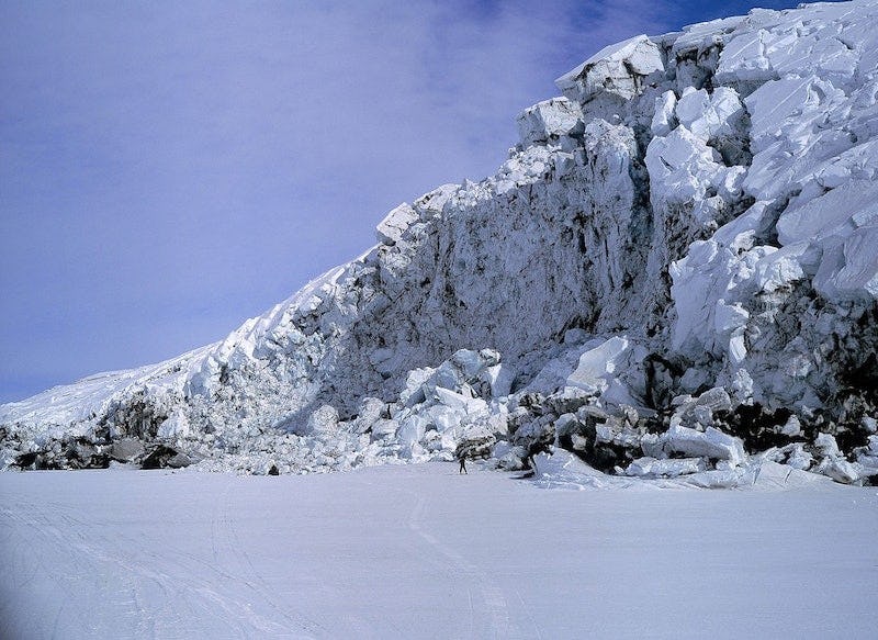
Meltwater that accumulates during subglacial eruptions can be released in catastrophic jökulhlaups, which may be hazardous to people and infrastructure. Eruptions and jökulhlaups from steep volcanoes like Öræfajökull destabilize the glacier itself, so that large blocks of ice break off and cascade downhill like an avalanche. Landforms created by such catastrophic events are found at the foothills of Öræfajökull and formed during the eruptions in 1362 and 1727.