Snæfell
About Snæfell
– come visit
About Snæfell
– come visit
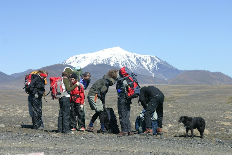
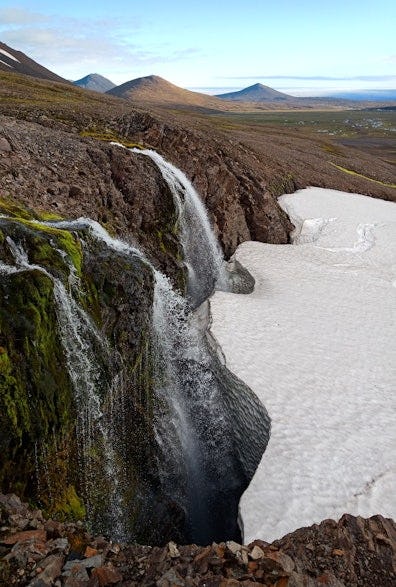
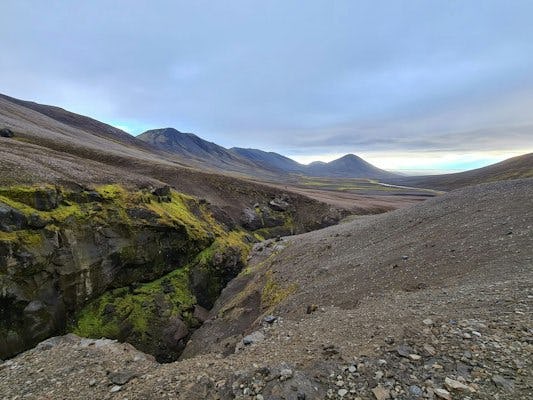
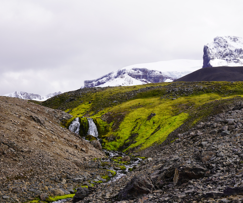
Snæfellsöræfi is a plateau around the ancient central volcano Snæfell and the tuff peaks that surround it. Snæfell, the fourth tallest mountain in Iceland, looms over travelers in the area. Snæfellsöræfi is particularly noteworthy for its rich vegetation compared to other regions in the highland, making it a good habitat for abundant wildlife and an internationally important wetland as well as creating unique landforms. Tourists flock to the area in the summertime, but winter tourism has also increased significantly thanks to a boom in the tourism industry in East Iceland.
Accessibility and services
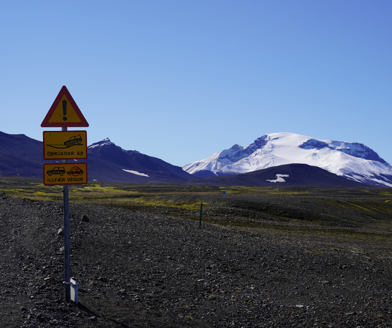
Snæfell is on the boundary of the municipalities of Fljótsdalshreppur and Múlaþing. Mountain road F910 leads to Snæfellsnesskáli. The road is accessible fairly late into the year compared to other mountain roads, and in recent years has usually become accessible in early July. There are two fords on mountain road F909 leading to Snæfell, but during the summer it is generally easily accessible by four-wheel drive jeep. The shortest route from Egilsstaðir is 93 kilometres long, 80 kilometres of which are paved. Snæfell is also accessible by other mountain roads.
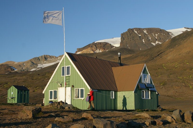
Ranger station in Snæfell
GPS coordinates: N64° 48.250' - W015° 38.600'
Park rangers can be reached by phone at 842 4367
Interpretation and information
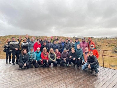
Park rangers are responsible for supervising and providing information about the region from the time the road becomes accessible until around the 20th of September, weather and road conditions permitting. The rangers' duties include providing information on the numerous hiking trails in the area, guiding visitors on informative walks according to the educational programme, and managing the Snæfell campsite and the Snæfellsskáli cabin.
Vatnajökull National Park's interpretation program is valid during the summer, offering a variety of hikes throughout the national park. You can find out about the summer's educational walks in the eastern area of the national park by clicking on the link.
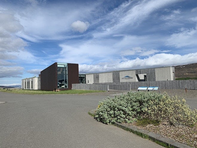
Snæfellsstofa
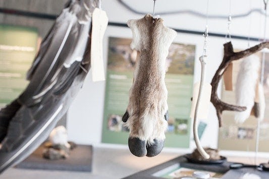
The Snæfellsstofa Visitor Centre is located in Skriðuklaustur in Fljótsdalur. The visitor centre is connected to Snæfellsöræfi and offers education and information as well as a souvenir shop. Snæfellsstofa Visitor Centre houses an exhibit about nature's cycles and its formation, with an emphasis on the region’s plant life, reindeer and other wildlife. The exhibit is designed so that children can touch, smell and try out its various items. During the summer, park rangers host educational events and children's activities.
Accommodation
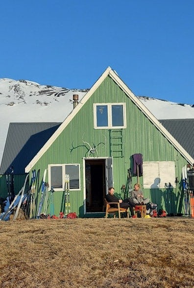
The Snæfellsskáli cabin is at Snæfell and accommodates around 45 people. There is also a campsite, flush toilets and showers. There are several mountain cabins in the nature reserve at Lónsöræfi or adjacent areas.
Queries and bookings by phone at 842-4367 or by e-mail at [email protected].
Snæfell
Snæfell hut – Þjófadalir valley
Bergskjár - Stroll from Snæfell hut
Embraced by glaciers - Visitor trail
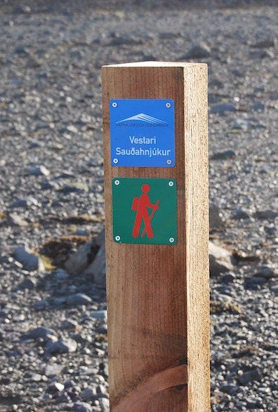
Vestari-Sauðahnjúkur
Vatnsdalur
Sótavistir
Snæfell hut – Laugarfell hut (through Þjófadalir Valleys)
Snæfellsskáli - Laugarfell (um Vatnsdal)
Snæfellshringurinn
Eyjabakkafoss cascades - Geldingafell hut
Nature & history
- learn & discover
Nature & history
- learn & discover
Snæfellsöræfi is particularly noteworthy for its rich vegetation compared to other regions in the highland, making it a good habitat for abundant wildlife and an internationally important wetland as well as creating unique landforms. Tourists flock to the area in the summer, but winter tourism has also seen a significant increase.
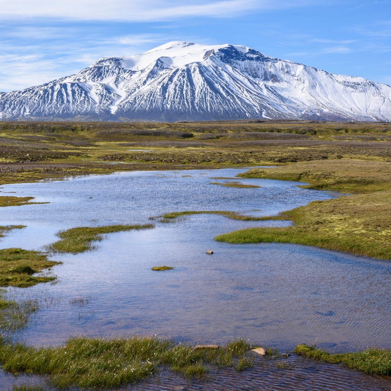
A landscape shaped by glaciers and rivers
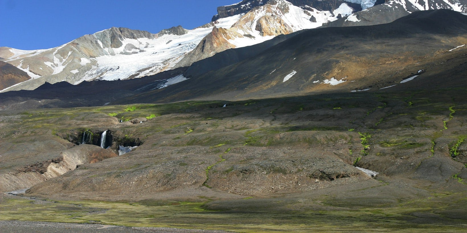
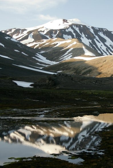
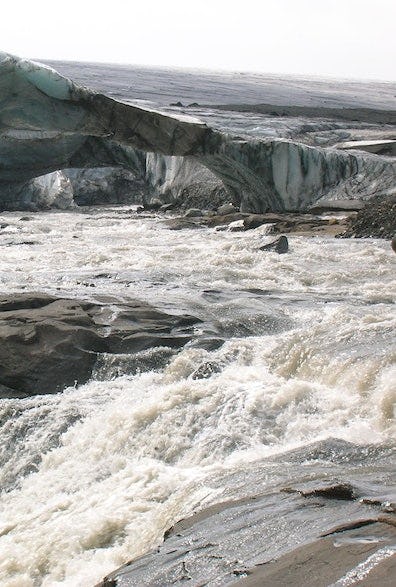
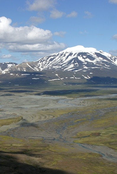
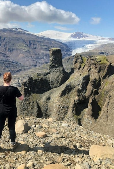
Glacier tongues and rivers shape the Snæfellsöræfi plateau. Vatnajökull's largest glacier tongue and the world's largest outlet glacier, Brúarjökull, marks the southern border of Snæfellsöræfi. In front of the glacier tongues, you can see unique landforms shaped by their powerful surges. These include the massive earthen mounds of Töðuhraukar, eskers and glacier combs. At the spout of the Eyjabakkajökull glacier is Eyjabakkar, formed by thousands of years of deposit from the river Jökulsá í Fljótsdal. The glaciers retreat rapidly, causing the landscape to constantly transform. New land is revealed and existing landforms change.
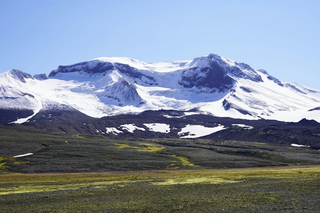
Mt. Snæfell
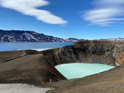
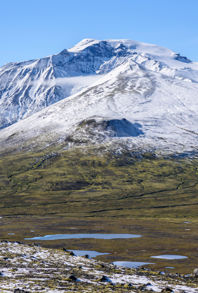
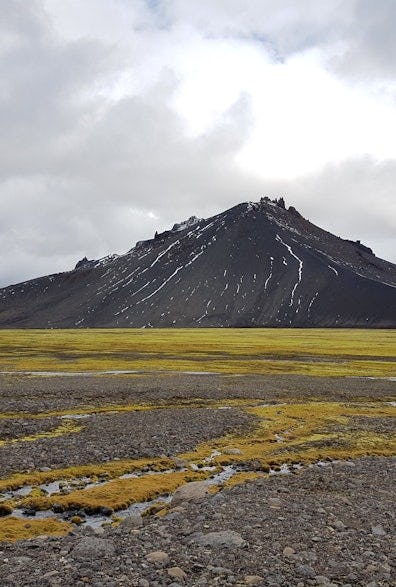
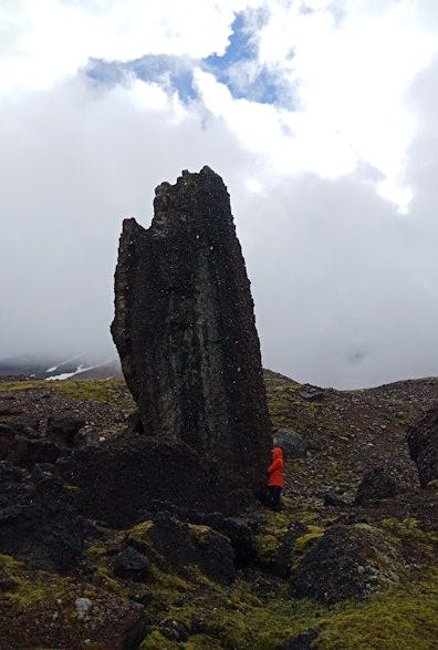
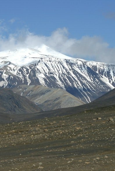
Snæfell is an ancient central volcano at the northeastern edge of Vatnajökull. It extends about a thousand metres above the plateau and is Iceland’s tallest mountain, apart from the glaciers, at 1833 metres above sea level. When Snæfell last erupted and whether it's still active or dormant is a matter of dispute. Snæfell and the peaks surrounding it belong to a unique lateral volcano belt, on the northeastern end of which sits Snæfell and the volcano Öræfajökull in the southwest. The strata that form Snæfell accumulated on the glacially levelled basalt bedrock over 400,000 years of repeated eruptions. The eruptions most often occurred under the Ice Age glacier. Hyaloclastite and rhyolite are the most prevalent types of rock in the mountain. At the top of Snæfell is a dome-shaped ice cap from which several glacier tongues descend, which are rapidly shrinking.
Snæfell and Eyjabakkar Ramsar sites
In 2013 the Snæfell and Eyjabakki area was approved as an internationally significant wetland area, or a so-called Ramsar site. The Ramsar Convention is an agreement concerning the conservation of wetlands, with particular emphasis on waders and waterfowl. The convention was adopted in 1971, in the Iranian city of Ramsar, and entered into effect in Iceland in 1977. The purpose of the convention was to address the massive decrease in wader populations and the extensive encroachment into their habitat. The aim is to protect the world's biological diversity and to promote a more viable future for mankind on Earth by protecting ecosystems and their habitats. For many years this was the convention's principal objective, but in recent years, ideas have also been raised about the importance of wetland areas for other reasons, such as outdoor activities and the maintenance of hydrological balance.