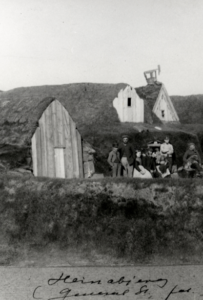
Heinaberg
About Heinaberg
– Come visit
About Heinaberg
– Come visit
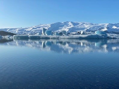
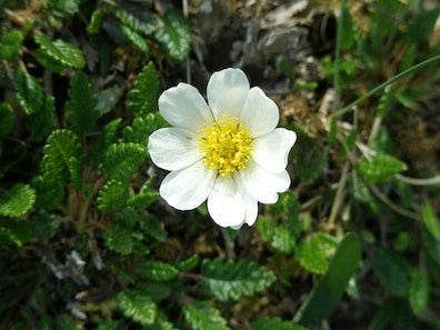
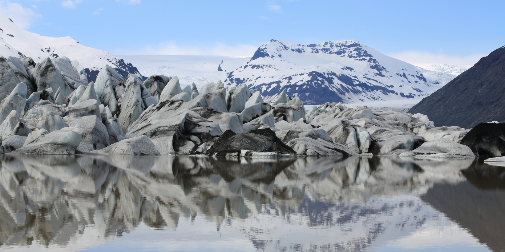
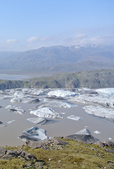
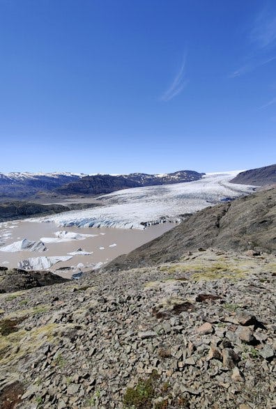
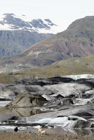
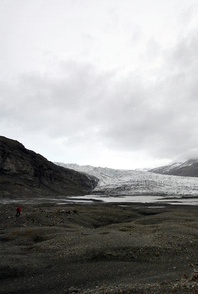
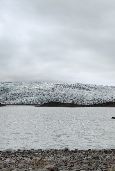
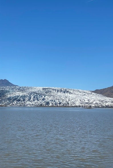
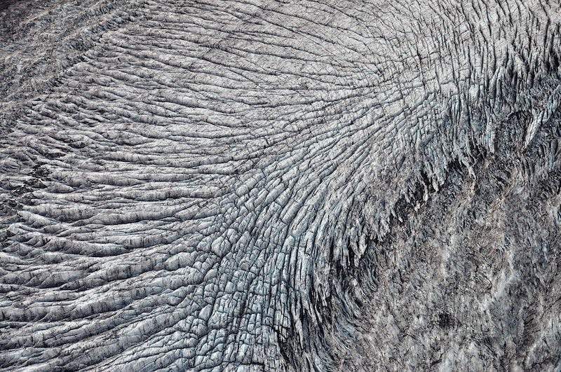
The glacier tongues at Hornafjörður - Skálafellsjökull, Heinabergsjökull, Fláajökull and Hoffellsjökull - are a hallmark of the region. . It's rare to find glaciers so close to settled areas. Large herds of reindeer can often be seen in the region from autumn to spring.
Accessibility, seasons and services
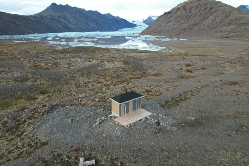
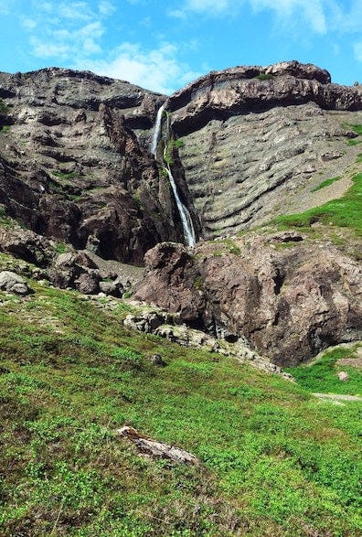
The turnoff road to Heinabergslón lagoon goes from Route 1 between Skálafell and Flatey. An 8-kilometer stretch of the road to Heinabergslón is unpaved gravel. After driving a little over 5 kilometers along the gravel road, you will reach an intersection. If you continue heading left, the road leads towards Heinabergslón. If you take the road to the right, you will pass the ruins of the old farm at Heinaberg on the way towards the Bólstaðafoss waterfall. It should be kept in mind that the road is difficult for ordinary city cars and it is recommended to travel around the area by four-wheel drive. There is a chemical toilet at Heinabergslón that is open year-round. Tourism services at Heinabergslón are seasonal.
The rangers at Breiðamerkursandur can be contacted by phone at 842-4355
Interpretation and information
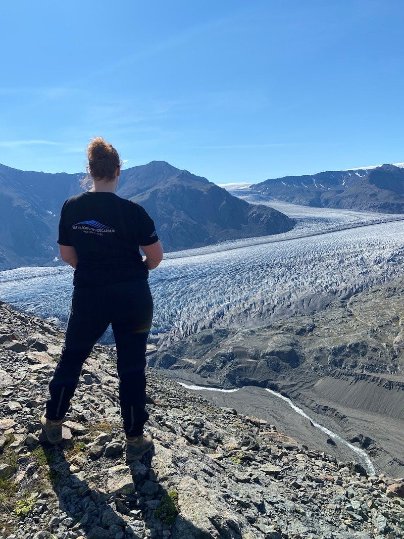
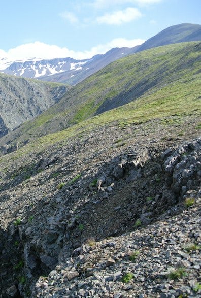
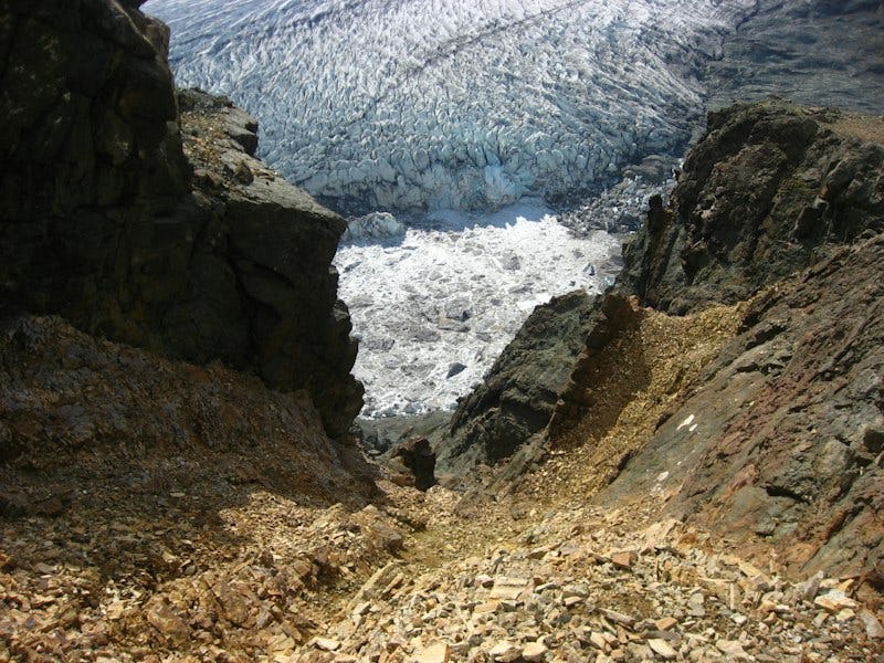
There are several marked hiking trails in the area, varying in length and the time it takes to walk them. From the parking lot at Heinabergslón is a short interpretive trail with informational plaques emphasising the vanishing glaciers. Booklets with information on the walking path are available at the sign in the parking lot. Reindeer can be spotted in the area, especially in the wintertime. Park rangers at Breiðamerkursandur handle the maintenance and supervision of Skálafellsjökull, Heinaberg and Hoffell. They also oversee the ice caves in Breiðamerkurjökull. There is a ranger stationed at Lónsöræfi during high summer who maintains the walking paths and provides tourist information.c
Vatnajökull National Park's interpretation program is valid during the summer, offering a variety of hikes throughout the national park. You can find out about the summer's educational walks in the southern area of the national park by clicking on the link.
Nature & history
- Learn & discover
Nature & history
- Learn & discover
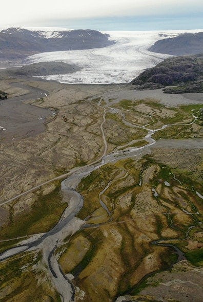
When the Vatnajökull glacier retreats, it exposes new land and changes the course of the glacial rivers. This creates conditions for wildlife to settle in the expansive sand flats and moraines. At the southern region of Vatnajökull National Park, experts and laypeople alike have an unique opportunity to observe the natural development of vegetation, wildlife settlement and formation of new ecosystems.
The battle with the rivers
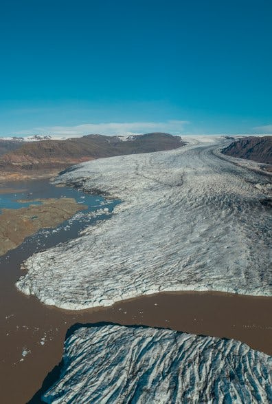
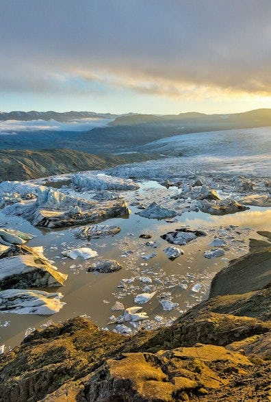
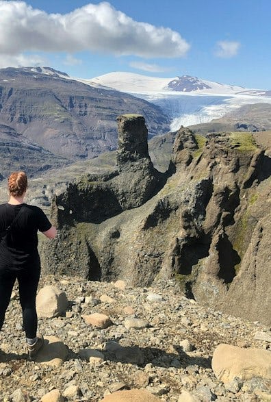
The Heinabergsjökull glacier is between the glaciers Skálafellsjökull to the west and Fláajökull to the east. These glacier tongues leave quite an impression on the region. Heinabergsjökull was at its largest around the year 1887. When Heinabergsjökull was at its most dense, it formed a sturdy dam and the lagoon overflowed into Vatnsdalur. Water from the lagoon then flooded onto the overflow over the rock threshold and down into the Heinabergsdalur valley.
The Vatnsdalur glacial floods were infamous for the destruction of farmland. At the end of the 19th century, Heinabergsjökull began to retreat and shrink. When the ice dam at the mouth of Vatnsdalur thinned out, the water was able to squeeze under it and stop flowing over the rock threshold. After that, the reservoir emptied at least once a year during rapid glacial flooding. The water made its way under the glacier through a tunnel at the bottom, bursting out from beneath its edge. The first Vatnsdalur glacial flood in 1898 was catastrophic, covering a large part of the lowland. Several farmsteads were deserted because of the encroachment of the floodwaters and sandstorms.
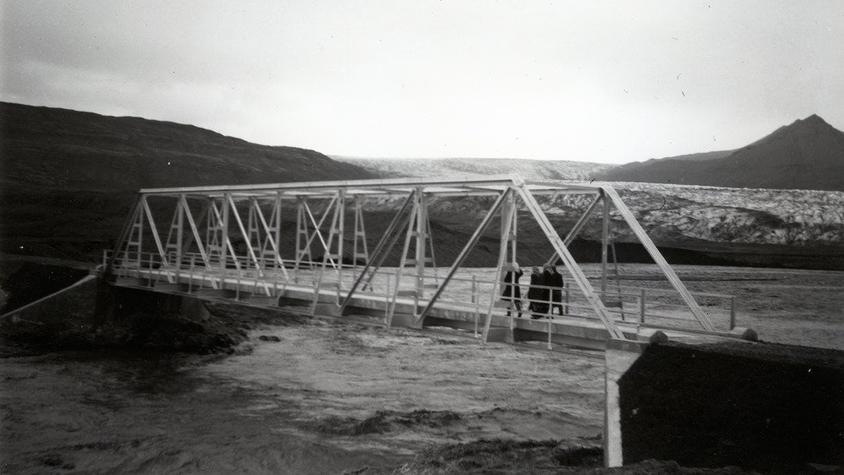
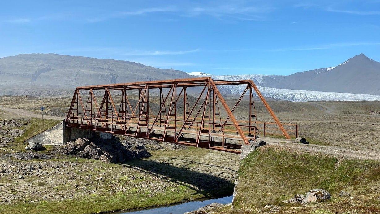
The bridge over Heinabergsvötn river
In the spring of 1947, construction began on this impressive bridge over Heinabergsvötn, which was a major obstacle to travel. The project was completed a year later. By autumn of 1948, however, the Heinabergsvötn lakes had completely shifted to the west into the course of the river Kolgríma. The reason for this is topographical changes that resulted from the retreat of the glaciers Skálafellsjökull and Heinabergsjökull. The bridge still connects the banks of the dry riverbed—a reminder of the transience of nature.
Melting glaciers
Close proximity to glaciers is nowhere near as abundant and their rapid changes as visible as south of Vatnajökull. A lot of emphasis is placed on education about climate change in the region, and you can also view the topic in more detail here.
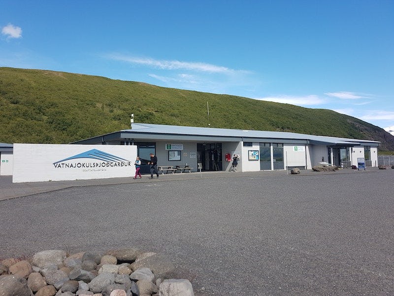
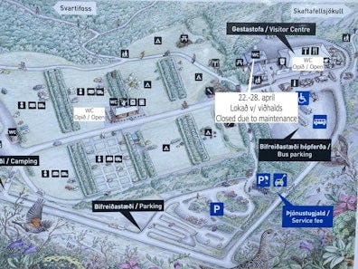
Skaftafellsstofa
Skaftafellsstofa is the visitor center of Vatnajökull National Park in the southern area. The visitor centre is open all year round. There, rangers and visitor centre assistants provide visitors with interpretation and information about Skaftafell's nature, hiking trails, accommodation and recreation in the immediate vicinity. In Skaftafellsstofa there is a souvenir shop with an emphasis on educational material and handicrafts from the region. In front of Skaftafellstofa there is an interpretation square where the emphasis is on providing good information about the area as well as teaching readers about the unique interaction between human habitation and nature in Skaftafell and the effects of climate change on human life and the environment.